PHOTOGRAMMETRY
The DJI Mavic 3 Enterprise RTK is a commercial version of the popular Mavic 3 photography drone. Critically, it is equipped with a mechanical shutter which can be triggered at 0.7 second intervals. The WGS84 lat lon ht of each image is recorded to the EXIF data of each image using the RTK correction and this is utilised in the photogrammetry processing. Current CAA rules require survey drones to be flown within visual line of sight (VLOS)
Some misconceptions exist about photogrammetry.
A correction device which itself is not corrected to OS grid and datum will ultimately generate a surface, correct within itself but possibly 4 metres wrong in height and position.
Despite the benefit of RTK correction there is always requirement for check points and possibly ground control points (GCPs). This is still accomplished on foot. Visiting those points with pole mounted receiver may take many times longer to administer than the actual flight mission.
In the Highlands at least, we cannot rely on a cellular network broadcast correction alone such is the poor mobile coverage. Referred to above, standalone correction devices cannot acquire a reliable OS position. A dedicated survey receiver like the Trimble R10/R12 can be configured to deliver wifi NTRIP correction to the drone controller. This offers a strong and stable correction. It should be noted that the pilot must remain anchored to wifi range of the receiver, so very large survey areas may require shifts of this bulky system.
In areas with strong phone signal, and particularly where the survey site is linear, the advantages of using network correction are clear.
GNSS RECEIVERS
Trimble R10/12 GNSS system
Survey grade GPS receivers are ubiquitous, and the Trimble units are among the most expensive. However, there is a level of integration between controller, receiver, scanner and total station that allows complex projects to continue seamlessly within the same job file. As well as being network correction enabled the receiver can acquire a position of 30mm accuracy by RTX correction service, when no phone signal is available.
Survey grade GPS receivers are ubiquitous, and the Trimble units are among the most expensive. However, there is a level of integration between controller, receiver, scanner and total station that allows complex projects to continue seamlessly within the same job file. As well as being network correction enabled the receiver can acquire a position of 30mm accuracy by RTX correction service, when no phone signal is available.
POINT CLOUD SCANNING TRIMBLE SX10
Trimble SX series
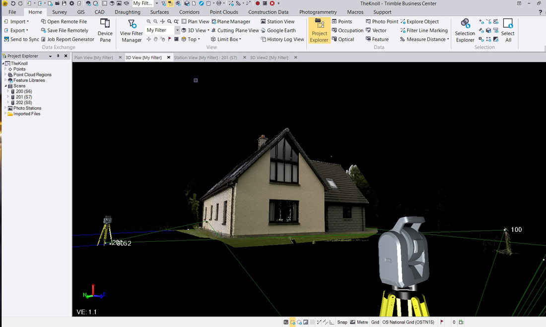
The Trimble SX integrates scanning facility within a 1 second total station chassis. It follows that control points (which are then scan positions) benefit from conventional traverse control logic, and scans assemble logically on screen without need of registration. It is yet possible to have a totally unknown set up position where the scan, to see hidden detail, can be later registered in TBC.
The Trimble SX integrates scanning facility within a 1 second total station chassis. It follows that control points (which are then scan positions) benefit from conventional traverse control logic, and scans assemble logically on screen without need of registration. It is yet possible to have a totally unknown set up position where the scan, to see hidden detail, can be later registered in TBC.
Site powered by Weebly. Managed by JustHost


